|
Contact Info: Rand McNally 1-800-275-7263 PalmInfocenter.com Bottom Line: The Price:
The Cons:
PalmInfoCenter.com Ratings*:
*Maximum Rating is FIVE (5) InfoPalms |
PalmPak Travel Card: Rand McNally Road Atlas Review By Kevin Crossman 1/2/02 Rand McNally and Palm jointly market the Rand McNally Road Atlas. It is available for any Palm OS device with an expansion card slot for SD/MMC and at least 1 MB of free memory. Currently, that means the m125, m500, m505, or HandEra 330. MSRP is $40 and it runs in color or grayscale.
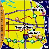
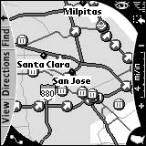
This application created a splash in November when it was named the winner of Best Mobile/Handheld Software Application at Comdex. The idea of replacing a giant paper product with a postage-stamp sized memory card is appealing. The product is easy to use and delivers very well on its features. The maps look great in color. You can zoom from 1 mile/inch all the way to 129 miles/inch. It should be noted, however, that zooms above 8 miles/inch do not provide very useful detail due to the Palm's low-res screen. The Interstate Exit function is extremely interesting. By selecting any exit (shown as a green arrow icon) on an Interstate highway you can obtain information on gas, food, lodging, ATMs, and points of interest. Only name brands are noted by name (e.g. McDonald's, Motel 6), otherwise there is just a listing of "miscellaneous" for independent "Mom and Pop" hotels, restaurants, and gas stations. If you regularly visit certain map locations you may save your maps for viewing at a later time. The city to city driving directions and mileage calculation work well. The search function works well, too, showing you services within a certain radius of a location, or searching by name. The search function is somewhat limited in that it searches only on the first words of a point of interest, rather than any word in the name. There are vast array or shopping centers and other attractions (shown as an orange icon) but at times the listings are less than complete. For example, the San Jose Children's Discovery Museum is listed but the Winchester Mystery House is not (this is one of San Jose's most famous landmarks and tourist attractions).
The product ships with compatibility with GPS systems. Unfortunately, I am not aware of any currently available GPS units which attach to any of the Universal Connector Palm Handhelds. However, Navman is supposed to be releasing one soon. Most of the limitations of this product are inherent by the Palm device screen and size. What it offers is an extremely portable version of the Road Atlas, handy when traveling or even just for fun. I found this product to be a great example of how to use SD/MCC technology well. I loved it but, of course, your mileage my vary. This product will be demonstrated by Kevin Crossman at the January 3rd meeting of the Silicon Valley Palm Users Group, http://www.svpug.com. Kevin Crossman is not affiliated with Palm or Rand McNally. |
Article Comments
(29 comments)
The following comments are owned by whoever posted them. PalmInfocenter is not responsible for them in any way.
Please Login or register here to add your comments.
![]() Comments Closed
Comments Closed
This article is no longer accepting new comments.
RE: Hook up a GPS
RE: Hook up a GPS
I have the Rand McNally StreetFinder GPS for the Palm III that works quite well with the other map programs out there, both on my old Palm IIIx and new HandEra 330. Mapopolis works very well and supports the HandEra's hi-res screen... a big plus in my book.
If you go with a simple cable attached unit, then there are companies that sell converters that will allow Palm III serial devices to attach to other types of handhelds... but I can't remember their names (search this site).
RE: Hook up a GPS
It's a little bulky in the car (and no reloading...), but it works.
I am curious how the driving directions would look with a GPS hooked up. I assume there is no GPS simulation mode, right?
Kevin, good article, thanks for that.
-B.
...Wherever you go, there you are...
RE: Hook up a GPS, and my opinion
In the program there is a GPS demo option from the menu. It shows a little purple (I think that's the color) crosshair moving along a route. The map kind of moves with it and you can also drag the map at the same time. In case you wanted to drag the map ahead of the GPS area a little bit. I didn't drag the map so far that the crosshairs went off the screen, but I can test it out later and post more if no one has added anything by then.
Pretty cool little app. It just doesn't get down very detailed, to the street level for instance, which is a bummer. I suppose it's not expected on a little 16MB card, but oh well. Maybe the could sell regions with more detailed info on em.
RE: Hook up a GPS
And since there is no street level information (and no route definition), I will also not get driving directions as in "in 1.2 Miles go right" - is that assumption correct?
-B.
...Wherever you go, there you are...
RE: Hook up a GPS
Pawgo is shipping for all palm models now
Null modems for all models
http://www.pawgo.com/desktop/default.html
Does it work for Clie?
RE: Does it work for Clie?
Any ideas on how to get around that?
RE: Does it work for Clie?
BTW - the PalmPak Games Card doesn't work for the Clie either.
-Kevin Crossman
RE: Does it work for Clie?
RE: Does it work for Clie?
---
News Editor
RE: Does it work for Clie?
Oh well, I am sure that someone will figure it out soon enough and I will implement it guilt free since I am paying for both.
Milpitas?
Hmm... maybe we could us it to house some of those Taliban prisoners..
Just a thought
RE: Does it work for Clie?
RE: Does it work for Clie?
Will R.M. offer updates?
RE: Will R.M. offer updates?
-Kevin Crossman
Still Needs Work
The look up function need some work to allow you use Graffiti letters to zero in on a location name rather than having pick from virtual alphabet buttons then scroll through tables and pick on a name. When you tap the USA start up map, and select Washington DC from the start up map and list, you still have to pick on W in the city index and select Washington again before it takes you to the Washington map. Clunky. This is a work in progress, and I look forward to future versions. You may want to skip this one.
Handera 330??
Great review.
Jeff
RE: Handera 330??
Possibly not. I picked up the Dictionary/Thesaurus that Palm sells, only to find out the PRC file would not execute on my 3.5.x HandEra 330 (said it needed OS 4). I guess we'll have to wait for HandEra to post the OS 4 upgrade.
Anyone else know?
BTW... If you want a really cool mapping program, w/GPS support, optional door-to-door directions, support for hi-res screens, etc... check out Mapopolis (www.mapopolis.com). Works very well and you can subscribe to updates at a reasonable cost.
Rand McNally Atlas
Rand McNally GPS for the Palm III for Trail Hiking??
Warning.. Road Atlas doesn't work with Magellan GPS
RE: Warning.. Road Atlas doesn't work with Magellan GPS
RE: Warning.. Road Atlas doesn't work with Magellan GPS
Latest Comments
- I got one -Tuckermaclain
- RE: Don't we have this already? -Tuckermaclain
- RE: Palm brand will return in 2018, with devices built by TCL -richf
- RE: Palm brand will return in 2018, with devices built by TCL -dmitrygr
- Palm phone on HDblog -palmato
- Palm PVG100 -hgoldner
- RE: Like Deja Vu -PacManFoo
- Like Deja Vu -T_W


Hook up a GPS
Tip DS